Groundbreaking Ceremony – Steep Bank Creek Pump Station Expansion
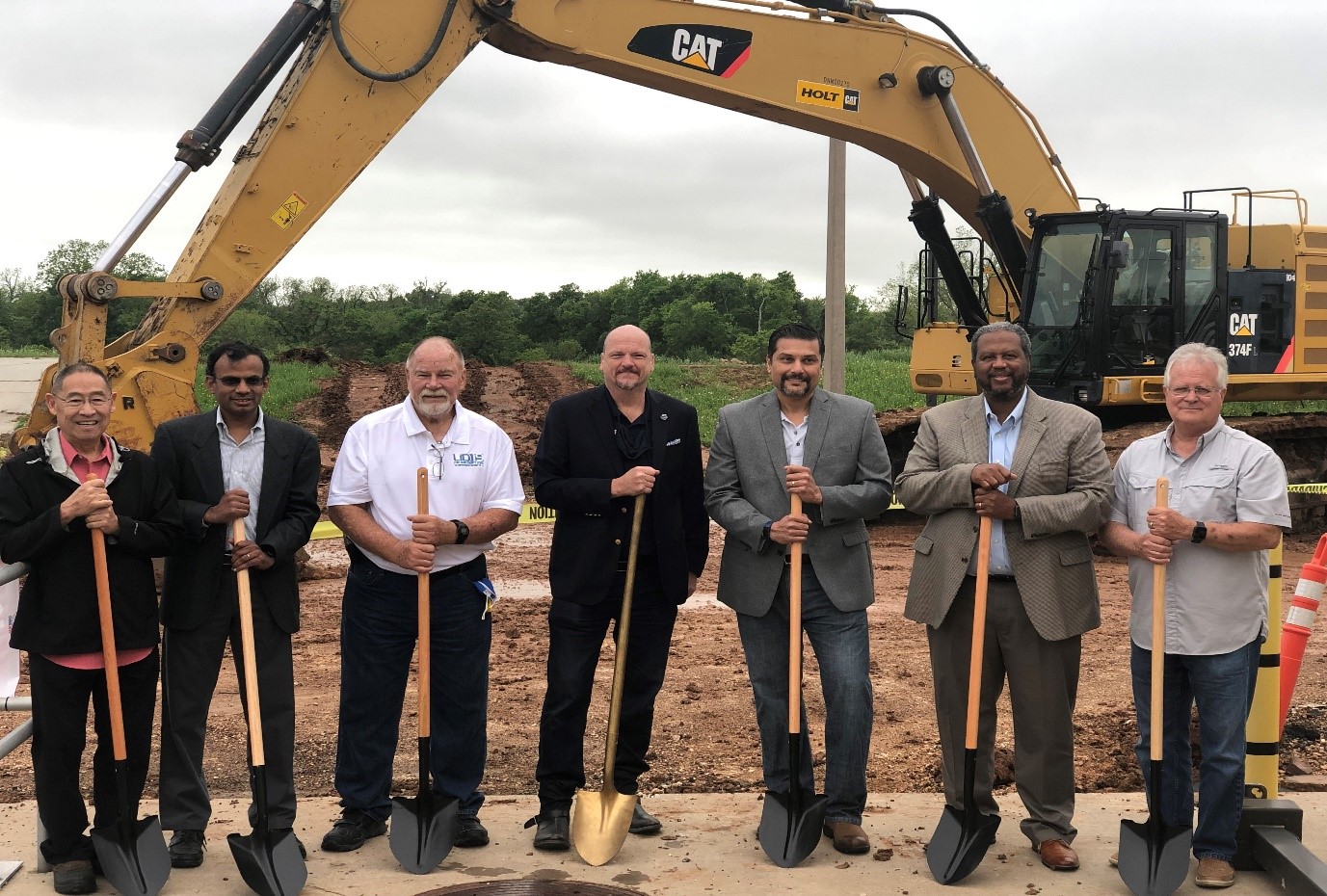
From left to right: Glenn Wong (LID 19), Sreekanth Pannala (LID 19), Dean Cooper (LID 19), Fort Bend County Commissioner Ken DeMerchant (Precinct 4), Rohit Sankholkar (LID 15), Fort Bend County Commissioner Grady Prestage (Precinct 2), and Jeff Anderson (LID 15).
Fort Bend County Levee Improvement District No. 15 (LID 15) is continuing its partnership with Fort Bend County Levee Improvement District No. 19 (LID 19) to improve flood control in the Steep Bank Creek watershed, which includes the eastern portion of LID 15. On Thursday, April 15, 2021 LID 15 and LID 19 broke ground on the Steep Bank Pump Station Expansion Project. Construction is expected to take one year to complete, so the expanded Steep Bank Creek Pump Station will be operational by May 2022. The pump station is located in LID 19 on Thompson Ferry Road, but this flood control facility is jointly operated by LID 15 and LID 19.
Currently, the Steep Bank Creek Pump Station has four pumps that combined remove up to 80,000 gallons of water per minute (GPM). Three new pumps will be added to increase the total pump capacity to 230,000 GPM. The facility is also home to 12 mobile pumps that can produce an additional 80,000 GPM. When complete, these improvements represent a 388% increase in pump capacity since Hurricane Harvey.
The Steep Bank Creek Pump Station is also equipped with a natural gas-powered generator to run the existing pumps during a power outage. The expansion project includes the installation of additional diesel generators to power the new pumps in the event of an outage. Construction will be sequenced to ensure that the existing pumps are available throughout the 2021 Hurricane Season.
The pump stations in LID 15 are exercised monthly and are operated when the Brazos River reaches flood stages that automatically close the flood gates in the levee. If it rains in LID 15 while the flood gates are closed, the pump stations are activated to remove runoff from inside the levee. Look for future updates about the Steep Bank Creek Pump Station Expansion Project on the LID 15 website and Facebook.